The Tour of the Unknown Coast is touted as “California’s Toughest Century.” Being that the Saturday, May 12, tour was my first 100-mile ride, I can’t say whether the claim is true or not, but it was definitely a grueling route and by far the toughest ride I’ve ever done.
More challenging than the sheer distance was the 9,700 feet of elevation gain, including a ridiculous climb up a hill with an 18-22 percent grade. For me that bordered on unrideable. There was the added challenge of a horrible headwind, which made what should have been an easy, flat 8-mile section of the ride along the coast feel like an uphill battle.
Although the ride was tough, I have to resist the temptation to slip into hyperbole. The TUC isn’t an impossible, Herculean feat. The fact that I was able to do it proves this.
There were men and women of all ages on the ride. One fellow informed me that he was 64 years old and this was his first TUC and that the week before he had completed his first century in Chico. Then he pedalled off and left me in the dust. I never saw him again.
For most it’s a recreational fun ride. There’s lots of food along the route, the scenery is beautiful and you get to enjoy the company of people who share your mental defect when it comes to bicycling.
But it does require preparation. I can’t imagine completing the route without some serious training.
PREPARATION
I suppose I began preparing for the ride last summer, even though I didn’t know it at the time. I purchased a pedal-assisted electric bike and used it for work and to get around town. That got my interested in using my regular bicycle. In a short amount of time I was logging four to 10 miles a day, four to six days a week.
By the end of the year I was not only bicycle commuting, but also doing some 20- to 25-mile recreational rides. When 2007 hit, I decided to make riding 100 miles in one day a New Year’s resolution and, soon after, I decided I would accomplish this goal by riding the Tour of the Unknown Coast.
And so began my “official” training rides. (For details on the rides I mention, see my blog archives.) I pedaled to Orick and back a couple times. I drove out to Prairie Creek Redwoods State Park and pedaled over the RNSP bypass. I climbed Kneeland.
IF YOU CAN DO MAPLE CREEK, YOU CAN DO THE TUC
When I had a routine checkup with my doctor, the topic of bicycling came up and it turned out he had done the TUC himself. He told me that the general rule of thumb is that if you can do what’s known as the Maple Creek ride, you can do the Tour of the Unknown Coast. So I did the Maple Creek ride two different times.
My biggest ride was 88 miles to Willow Creek and back. After I did that, I didn’t have any doubt that I’d be able to finish the TUC. My only concern was how slow I’d go and how often I’d have to stop and rest near the end of the ride. But that didn’t really matter because my only real goal was to enter the TUC and finish it.
The night before the ride I carefully packed my bicycle into my car and made sure I had everything I needed onboard, including tools, two spare tubes, bicycle pump, a helmet, two extra-large water bottles, raincoat, mittens and a camera. I also packed a giant Snickers bar, just in case the TUC rest stops ran out of food.
For dinner I ate a hearty meal of chicken breast filled with onions and bacon and served with a pile of whole-grain noodles. I washed that down with some red wine and went to sleep at 11 a.m.
RACE DAY
I awoke at 5:15 a.m., brushed my teeth, slapped on my bicycle clothes and left the house. There’s no need for any fancy grooming when you’re about to ride 100 miles.
My first stop was the McKinleyville McDonald’s, where I ordered an Egg McMuffin, a McHashbrown and a large McCoffee with McCream and McSugar. That may sound like an odd breakfast to eat before an athletic event, but I wanted something substantial – with a lot of calories – that would keep me fueled up as long as possible.
In my experience, eggs and potatoes go a long way, while a healthy breakfast of fruit and oatmeal is almost worthless. Besides, I’ve been eating oatmeal since the year began and I’m sick of it! As of May 12, no more oatmeal.
I ate breakfast while driving and arrived at the fairgrounds in Ferndale at around 6:15 a.m. I registered, got my event T-shirt, returned to my car and prepared my bicycle. I greased the chain, double checked that I had everything that I needed and then slowly cruised around the fairgrounds to check out what everyone else was doing.
BICYCLE ENVY
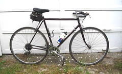
Before the “race” even started I was struck by a bad case of bicycle envy and doubts about the adequacy of my Mighty Panasonic.
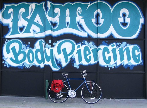
Nearly everyone had fancy, expensive-looking road bikes. There were lots of new-looking LeMondes and high-end Cannondales. They were stripped down and outfitted with only small tool bags.
They were in stark contrast to my ride: an early 1980s steel road bike with fenders, a rear rack, panniers and an old Mickey Mouse bell. I was probably the only one riding a bike with moustache handlebars, and surely the only one with a kickstand.
AND THEY’RE OFF!
Shortly before 7 a.m. riders began to swarm like bees at the starting line. Riders were coming and going and the excitement was building. I position myself near the rear. What’s the rush when you’ve got 100 miles in front of you?
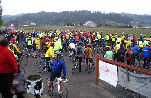
Here’s a photo of the start.
Some guy on a loudspeaker spoke for a few minutes. I couldn’t hear a single word he said, but I’m sure it was all very important and informative.
Then everyone started moving forward – the race was on. With cyclists in front, in back and on each side, it was all very exciting. It reminded me of the movie “Breaking Away.” The adrenaline was pumping and I had an incredible urge to pedal as fast as I could, weave my way through the pack and make my way to the front. But that would be stupid. (And impossible, given the pros who were seriously competing.) I had stay cool and pace myself.
EMERGENCY COOKIES
We made our way through the Ferndale Bottoms and the pack slowly thinned out. Some riders fell behind me, but even more passed me and pedaled off into the distance. Still, I felt like I was breezing along at a decent pace. I was nice and relaxed.
About 13 miles into the ride we came across the first “Aid Station.” It seemed way too early to stop for fuel, but since everyone else was doing so I went along with the crowd. I grabbed a bag of Famous Amos chocolate chip cookies, ate one and stashed the rest in my panniers. Stopping here was unnecessary and a waste of time, except for the fact I now had emergency cookies on board. They could come in handy down the road.
OVERPACKED
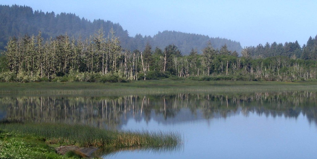
I breezed through Rio Dell and Scotia. Beautiful. The sky, as you can see, was dark and gray. I hoped it wouldn’t rain. Then again, if it didn’t rain, how could I justify carrying a raincoat 100 miles? Damn, I had overpacked! I even brought some extra bungee cords. What was I going to do? Use them to strap a chunk of souvenir driftwood from the Unknown Coast on my bike rack?
I passed through the Avenue of Giants and a thought occurred to me – I had pedaled through these exact same trees about a quarter century ago with my parents when we went on a camping trip. I had a teal-colored 10-speed at the time that I had fished out of a drainage ditch and fixed up. Here I am a quarter century later and I’m still doing the same thing I did when I was in middle school – fixing up old bikes and riding them around.
I was pleasantly surprised to find a full-blown aid station at mile 25 near Pepperwood. This was the turnaround point for cyclists in the 50-mile ride.
That Egg McMuffin was still keeping me going and I didn’t really need to eat, but they had bagels with peanut butter, so I couldn’t resist. I turned down the sandwiches and other goodies, which was hard to do. When people offer me free food, I usually indulge myself. It’s the polite thing to do.
THE CLIMBING BEGINS
From there it was on to the Bull Creek Road/Honeydew exit and then the Albee Creek Aid Station at mile 38. Up to this point the tour had been a relaxing fun ride with minimal hills. Everyone was in good spirits and nobody showed any signs of being tired.
That would soon change as the 6.8 mile ascent to Panther Gap Ridge was about to begin. Although everyone talks about climbing “The Wall” at mile 81.5, Panther Gap Ridge is the real killer with an elevation of 2,744 feet. You wind your way to the top, one switchback after another.
These climbs were a lot harder than State Highway 299 to Willow Creek and back. Those roads are designed for trucks. Although the elevation gain is substantial, the grades are not. The TUC route is brutally steep, narrow and peppered with potholes and gravel patches.
No matter how much training I do, such hill climbing is just plain difficult for me. I was sweating like a pig and my muscles hurt. There was really nothing to do but tuck my head down and keep on pumping. Every mile or so I would stop and chug some water.
Along the way a few riders got flat tires. One guy had broken spokes on a fancy wheel that didn’t have too many spokes to begin with. I suspect he was one of the first to take the sag wagon home.
About half way up I started getting hungry. And then even hungrier. The Egg McMuffin was wearing off.
At one point I asked a fellow rider how he was doing. He responded with a one-word answer: Suffering.
ALMOST HALFWAY
At mile 48.4 I noticed a large group of cyclists on the side of the road putting on jackets. Thank goodness! Even though it didn’t look like it, this was the summit. I piled on clothes for the descent, including a pair of mittens.
Man, was I glad I brought mittens. The descent was chilly, and even with the mittens my fingers were half-frozen when I reached the bottom. Not only that, but my hands and arms were sore from all the braking and maneuvering around potholes. In Honeydew other riders were talking about the same problem, so I wasn’t alone.
I refilled my water bottles and got back on the road. I was really looking forward to lunch at mile 63. After that climb I needed to refuel and get my second wind.
BEST SOUP EVER!
A full lunch was served at AW Way Park at mile 63. There was a woman ladling soup into paper cups. I grabbed a cup and a spoon and ate it standing up – I was so hungry I didn’t feel like wasting any time finding a place to sit. This was the best soup I ever had – a homemade vegetable soup with chunks of potato, corn and green beans. This wasn’t like that wretched Campbell’s veggie soup, which is cooked down to a disguting, watery mash. The veggies were nice and firm, some even crisp. Hats off to the chef. After the soup I devoured a tuna sandwich. Then I had a cream cheese/veggie sandwich.
The nice thing about the food was that it was prepared and wrapped up in tiny portions – with each individual sandwich being about one-third the size of a regular sandwich. They were small, but you could eat as many as you wanted. The bananas and bagels were also cut in half. This allowed riders to eat what they wanted without wasting any. I thought that was pretty smart.
Also, the food was delicious – not in the gourmet sense, but it just hit the spot. It was as if the person who planned the food knew exactly what my body desired along the way.
Being fed and watered on a bike ride made me feel like royalty. I’ll bet when Prince Harry goes on a bike ride, it’s something like the TUC – except shorter and with lots of hookers and caviar.
ONWARD TO THE COAST
At the lunch area I thought about just laying down and resting, but decided against it. Why? Because of my strategy for finishing the race. My plan was to keep on pedaling. If I got so tired that finishing seemed questionable, then I’d just rest every half mile or so until I got to the finish line. This could be time consuming so I didn’t want to waste precious minutes at mile 63.
So onward I went. I had hoped that the lunch would give me a burst of energy, but it didn’t. I was still a little tired. Not horribly so, but enough so that I didn’t have any “spark” when I hit the hills. It was a slow trudge.
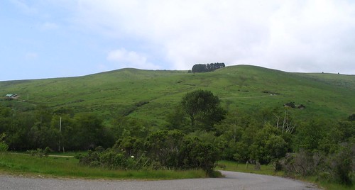
The scenery in the Petrolia area is spectacular. There were lots of nice photo opportunities on the ride, but I was focused on riding and didn’t feel like much of a shutterbug.
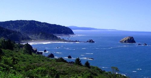
Shortly before mile 73 the course descends to the coast. It’s worth pointing out that the “Tour of the Unknown Coast” only includes about 8 miles of roadway on the actual coast, or at least near the beach. And that was just fine with me because as soon as I was on the coast I wanted to get off the coast due to a horrible headwind.
The wind was so strong I had to pedal along in low-gear as if I was climbing a hill. I was actually looking forward to “The Wall” so I could get out of the wind.
ROYAL. CROWN. COLA.
“The Wall” came at mile 81.5. I had mixed feelings at this point. I was somewhat relieved that I only had 18.5 miles left to finish the course. On the other hand, a good portion of that distance included serious – and steep – elevation gain.

Fortunately I had driven out to Petrolia a few months earlier and pedaled up “The Wall.” That helped because I knew what to expect and I knew I could climb it without walking, but just barely.
When making such a climb, there’s an internal dialogue that I have with myself. A good portion of it includes colorful four-letter words, kind of like the scene in “The 40 Year Old Virgin” when the main character gets a wax job.
On Saturday I added counting to the mix, as in “One! Two! Three!” in time with my crank rotations. At one point I began to crave a cold soda and envisioned a tall, bubbly glass of Royal Crown Cola. I kept thinking about that soda as my knees strained to get up the hill.
Royal. Crown. Cola.
Pedal. Pedal. Pedal.
Royal, Crown. Cola.
Pedal. Pedal. Pedal.
Royal. Crown. Cola.
And so it went up “The Wall.” Not exactly deep thinking on my part, but a brainless mantra to keep me going.
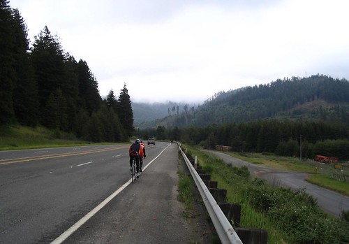
ENDLESS HILL
I got to the top and descended down the other side. At about mile 86.7 there was an unmanned aid station with some jugs of water, oranges and some packets of something called Hammer Gel.
I had previously seen riders sucking on little plastic packets and noticed lots of them littering the roadway along with a large number of water bottles that seemed to have fallen off people’s bicycles. I thought the plastic packets contained some sort of sport drink, but it turned out they were a “Rapid Energy Fuel.”
I was feeling tired and decided to try one before conquering the “Endless Hill.” I squeezed a packet of banana-flavored goo into my mouth and washed it down.
“That was absolutely disgusting. It better work,” I told a fellow rider. He responded that if something taste that terrible, it will probably work.
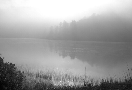
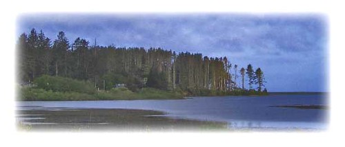
I can’t say whether it helped or not. I struggled up the “Endless Hill,” which you can see in this photo. There was a strong headwind the entire way.
The pack was really thinning out and several sag wagons went by filled with bicycles and riders. Part way up the hill there was another aid station. I drank water and devoured an orange.
A rider told me that his fancy watch – which monitored his pulse and God knows what else – informed him that he had burned about 7,000 calories so far. That explains the importance of food on such a ride.
After that orange – and the realization that I was close to the end – I got a burst of energy. I pedaled a little faster and, amazingly, passed a few riders.
Another sag wagon went by with lots of riders on board. I felt sorry for them, but I was elated not to be one of them.
At mile 96 I was at the top of the hill. I put on a jacket and gloves and reminded myself to be careful; I was almost done and the only thing that would stop me now was a bad crash.
I made my way down to Ferndale. There were no riders in sight behind me or in front of me. The streets were empty.
As I approached the finish line I was ecstatic and had an indescribable sense of accomplishment. I looked at my watch and realized I had finished the route in 10 hours and 55 minutes. If I was a better man I’d round that off to an even 11 hours, but I felt like I earned that extra five minutes somewhere along the route.
At the finish line there were two race officials. They were probably cold and tired after a long day as they greeted me with a lackluster “congratulations,” but I didn’t care. Then they explained that they had run out of the “100-mile finisher” patches, so I would get a patch that just said “finisher.” I wish they wouldn’t have told me that because I wouldn’t have known that there was a difference. But, frankly, I didn’t care at that moment and told them so. I was just happy as a clam to finish.
And that was it.
CP had wanted to greet me at the finish line but I talked her out of it. It wouldn’t make sense to drive all the way out to Ferndale and wait for hours upon hours in the cold for this, especially considering I couldn’t tell her when I would be done.
The parking lot was nearly empty. I put my bike in the car and then made my way to the promised “Mexican Buffet” at the fairgrounds. There was a table with raffle items. I checked my raffle tickets and was pleasantly surprised to discover that I won a pound of coffee. Bitchin!
At the serving table there was a pile of flour tortillas, a tray of some sort of meat substance, and a tray of beans. The server was apologetic, but I told him not to worry – just start scooping because no matter what he served me I was going to enjoy every bite. And I did.
On the way back to my car, about 25 minutes after I had finished the race, I saw another rider coming in. He was a fellow I had passed on “The Wall.” In those last 18.5 miles he had slipped about 30 minutes behind me. But he finished, which is what counts.
EPILOGUE
One of my first thoughts as I approached the finish line was how I wanted to do the tour again – but next time on a better bicycle. So my next project will be to fix up the Cannondale I picked up for free on craigslist.org.
Next year I plan to beat my time by an hour or two.
I’m also thinking about doing some other centuries, although I haven’t explored my options yet.
My next bicycle adventure – not counting my day-to-day commuting – may be the bicycle race during McKinleyville’s Azalea Festival June 2. Stay tuned...
(Note: When I got home, I still had a bag of Famous Amos cookies and a Snickers bar. That was good, because after burning all those calories I got the munchies 24 hours later.)